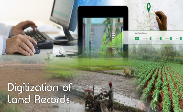
Digital India Land Records Modernization Programme (DILRMP) with the aims to modernize management of updated land records and to usher in a system of automated and automatic mutation, inter-connectivity between revenue and registration, to replace the present deeds registration and presumptive title system and facilitate moving eventually towards guaranteed conclusive titles to immovable properties in the Country so as to minimize scope of land/property disputes, enhance transparency in the land records maintenance system; was launched by Government of India on 21 August, 2008 by merger of the then being implemented since 1988, two Centrally Sponsored Schemes of the Land Reforms (LR) Division: (1) Computerization of Land Records (CLR) & (2) Strengthening of Revenue Administration and Updating of Land Records (SRA&ULR). The District has been taken as the unit of implementation, where all programme activities are to converge. It was hoped that all 620 districts in the country would be covered by 2017 at the end of the 12th Plan period except where cadastral surveys were being done for the first time. The scheme did not see much headway as it proved to be a challenging one from the cost perspective.
DILRMP has the main objective to develop a modern, comprehensive and transparent land records management system in the country with the aim to implement the conclusive land-titling system with title guarantee, to be based on four basic principles:
- Single Window to handle land records including the maintenance and updating of textual records, maps, survey and settlement operations and registration of immovable property,
- Mirror principle, which refers to the fact that cadastral records mirror the ground reality,
- Curtain principle which indicates that the record of title is a true depiction of the ownership status, mutation is automated and automatic following registration and the reference to past records is not necessary, and
- Title Insurance, which guarantees the title for its correctness and indemnifies the title holder against loss arising on account of any defect therein.
DILRMP has 3 major components:
- Computerization of all land records including mutations, digitization of maps and integration of textual and spatial data,
- Survey/re-survey and updating of all survey and settlement records including creation of original cadastral records wherever necessary,
- Computerization of Registration and its integration with the land records maintenance system, development of core Geospatial Information System (GIS) and capacity building.
Modi government in the year 2016-17 took an important step and supported The Land Transformation Management System to tackle the nuisance of illegal land acquisition cases, in the light of the land scam case that had surfaced against retired IAS officer GS Sandhu, who allegedly transferred a society deed of a land measuring 40,000 square yards to a builder against norms in 2011 when he was additional chief secretary, urban development and housing. This will put an end to age old malpractices of fraud in land transactions. Land being the costliest asset in realty has often been the focus of land fights, property crimes and frauds.
Digitization of land records has been re-launched & implemented from 1 April, 2016 under the National Land Records Modernization Programme with a view to minimise the scope of land disputes, and enhance transparency in the land records maintenance system. In the Budget 2016, Union Finance Minister Arun Jaitley allocated Rs 150 crore for the purpose. In past the absence of any effective land records maintenance system was one of the biggest challenges that gripped India in land ownership issue. Here, one was only presumed to be an owner and not a conclusive owner of land unless proved otherwise. Apart from this, inaccurate physical records and security issues of sharing land records publicly were some areas of concern.
The government too, faced difficulties. Many a times, land acquisition for development projects were done but the 7/12 land extract (an extract from the land register maintained by the revenue department) did not reflect these changes. Thus, the land acquired was fraudulently sold to another person by taking advantage of this loophole. In some cases, people had mortgaged acquired properties for obtaining bank loans, stated a revenue official.
In the digitization process, Tehsildars would first compile land data. Complete details of a parcel of land, from the original owner, period of ownership, year of purchase to number of transactions to the current status of land, the revenue officials need to collect all these details and take an image of the land (property). For records on land availability, a fresh survey of lands would be conducted and every parcel of land counted and details noted. After this, digitization process begins. Online data would be compared with the manual data to rule out any errors. Digitization of land records would ensure requisite details – map of the land, mutation, photo ID, etc., a step towards conclusive ownership.
At the behest of Prime Minister Narendra Modi, all land records now will be integrated with Aadhaar, a step taken to monitor the successful implementation of crop insurance scheme. A bill recently passed in Parliament has made Aadhaar mandatory for residents to avail themselves of any public service. Clarity on land ownership would also reveal the quantum of land possessed by a person. Most importantly, people would be able to purchase land, give deeds, and do mutation entry and all kinds of land transactions fearlessly at the press of a button. Online registration will delete any confusion about which land has been earmarked as government land. The government and revenue officials would have the exact details of land available at hand post digitization. The government land would be safe from encroachers.
In order to further push digitization and fight against black money, the Centre has asked all state governments’ revenue departments to record all land records online and link Aadhaar numbers to each of these transactions, including existing land records. Once the state authorities are able to link all PAN with Aadhaar numbers to the land record databases, the investigation officials and tax department can make searches to match property values with annual income declared and tax return files.
Under the Benami Transactions (Prohibition) Amendment Act, 2016, that came into force in November 2016, the government can now confiscate property without paying any compensation to the buyer if they find any discrepancies.
Real estate is the most popular means to park unaccounted money, and is considered the hub for generation of black money where a large number of benami transactions take place. Experts believe the Amendment Act will further reduce black money transactions, thereby adjusting prices as per the set land value, making it accessible for buyers to buy a property without hassles.
States like Haryana, Uttar Pradesh, Maharashtra, Chhattisgarh, Andhra Pradesh and Telangana are among the states whose land revenue departments are in the process of linking Aadhaar with land records and making it complete digitized. The Maharashtra government is already in discussions with the National Informatics Centre to link the land records, property ownership with the Aadhaar number of the owner. For instance in Uttar Pradesh, the NOIDA administration has already converted the physical records in to digital records of over 16,000 institutional, industrial and commercial properties. Now both Noida and Greater Noida administrations are undertaking a project to provide all land/property related certificates /documents /papers etc., which will be digitally readable and verifiable.
Once complete, this will be a valuable step in catching those with benami properties across the country. Having a clear picture of people’s properties mapped, registered and valued will lead to good planning. It will eliminate conflicting land right claims to the land or over compensation for the land in question being acquired.
The digitization of land records, apart from providing conclusive titles to land owners and speeding up the process of land acquisition, also could lead to a buildup of local revenues through improved property tax billing and collection.


